


by Lauren DeLorenzo, Journalist, Council magazine
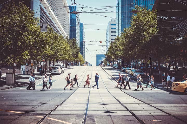
With initiatives such as Sydney’s $43.5 million George Street transformation project underway, councils are seeking ways to make cities safer and more welcoming in the face of the pandemic. But as we expand pedestrian spaces and increase outdoor dining, it’s vital to understand the way city streets are currently being used. An RMIT study outlined how streets are being used to cater for different modes of transport in Melbourne, and how they could be adapted for more equitable use.
Although city spaces have seen many changes since the beginning of the pandemic, very few studies have measured the impact of these moves on pedestrians, motorists, cyclists and public transport users.
To better understand this, RMIT’s Centre for Urban Research mapped the use of each mode of transport in Melbourne, compared to how much space is allocated for each.
Lead researcher, Dr Chris De Gruyter, said that the study revealed the unrealised potential for Melbourne to make more equitable and efficient use of its space.
“Despite the move towards reallocating on-street car parking for outdoor dining, we found that very few studies worldwide have explicitly measured how much actual street space is allocated and used by each mode of transport, particularly in Australian cities,” Dr De Gruyter said.
“This is particularly relevant in areas such as shopping strips, where high traffic flows typically conflict with popular places and key destinations.
“It is also relevant in the context of the pandemic, where greater space is being sought to support physical distancing, alongside efforts to increase outdoor dining opportunities through converting on-street car parking to ‘parklets’.”
For many cities, street space is strongly contested, particularly where high traffic flows meet key destinations and popular areas.
Understanding how these spaces operate and how they can be made safer and more efficient could be a key part of making Melbourne more sustainable and welcoming people back into the city.
How is street space currently allocated?
The study examined surveys taken from 57 shopping strip locations in Melbourne, most within 10km of the city’s CBD.
Researchers counted the number of people going past a specific point, and then sorted them into categories depending on what type of transport they were using.
These findings were then compared to the amount of street width that was allocated for that mode of transport. This was turned into a measurement of concentration (the amount of people per kilometre using that mode of transport) to account for different travel speeds.
A key finding from the study revealed that Melbourne’s shopping strips lacked adequate pedestrian space.
On average, pedestrians are given 33 per cent of street space, but account for 56 per cent of all travelers.
Meanwhile, other modes of transport were found to take up much more space than their average use suggests is needed. On-street car parking takes up 21 per cent of street space on average, but only accounts for 13 per cent of all travelers.
Shared general traffic and bus lanes were also found to take up a greater amount of allocated space than required, using 42 per cent of street space to cater for 29 per cent of total travelers.
Transforming streets for pedestrian use
Dr De Gruyter said that the study, “presents an opportunity to introduce wider footpaths and more outdoor dining through converting on-street car parking space, where it is considered appropriate to do so”.
As part of its COVID-19 recovery efforts, the City of Melbourne purchased $1.1 million in parklet infrastructure to transform on-street car parking spaces into expanded outdoor dining areas.
Dr De Gruyter said that this approach provided an opportunity to enable outdoor dining without encroaching on valuable footpath space.
However, solutions for better street space management will largely depend on the specific needs of the area, as the findings were highly variable depending on the location being studied.
Puckle Street in Moonee Ponds, for example, had a much higher discrepancy between pedestrian traffic and allocated space, with pedestrians accounting for more than 80 per cent of travelers but having only 35 per cent of the street space allocated to them.
“While recognising that the reallocation of street space involves a range of governance, political and ethical considerations, efforts to reallocate street space should also be informed by empirical evidence of street space allocation and use,” Dr De Gruyter said.
“Our study findings provide an evidence base that can help local governments in distributing street space more equitably to users, and support broader goals for increasing the uptake of more sustainable forms of transport.”
Encouraging local living and sustainability
Data on street space allocation can help keep communities safe from COVID-19, avoiding cramped pedestrian spaces and encouraging alternative COVID-safe forms of transport.
But understanding the best use of street space can have further implications beyond making travel more comfortable – it can also help local governments meet broader community objectives.
“Increased pedestrian space and better planned streets, particularly in shopping strip locations, can support broader objectives for increasing the uptake of walking, cycling and public transport, and reducing our reliance on the private car,” Dr De Gruyter said.
“Doing so can further support the concept of local living and recognise that shopping strip locations are ‘places’ in their own right, rather than main roads only where traffic passes through.
“This is particularly relevant in areas where movement and place objectives are in conflict with one another, such as activity centres, and where cities are looking to provide greater priority to more sustainable forms of transport.”


Would it be possible to obtain a contact at RMIT to discuss this in more detail? I am currently scoping a range of smart city technologies for use in designing urban areas, and this research is very well aligned.